Krishna Nadi — The Sacred Artery of the Deccan Plateau 🌊🕉️
The Krishna Nadi is one of Bharat’s great peninsular rivers, flowing as a life-giving artery across the Deccan Plateau. Rising in the Western Ghats and traveling eastward to the Bay of Bengal, the Krishna has shaped agriculture, temple culture, pilgrimage routes, and dynastic capitals for over two millennia. Along its banks stand ancient kshetras, ghats, forts, and learning centers, reflecting an integrated civilization where ecology, devotion, and settlement evolved together.
Formation and Geography 🏔️💧
The Krishna River originates near Mahabaleshwar in Maharashtra, at an elevation of about 1,337 meters in the Western Ghats. The region receives heavy monsoon rainfall, feeding perennial springs that give birth to the river.
From there, the Krishna flows approximately 1,400 km, traversing Maharashtra, Karnataka, Telangana, and Andhra Pradesh before emptying into the Bay of Bengal near Hamsaladeevi.
Geographical Features of Krishna 📊
| Feature | Detail |
|---|---|
| Source | Mahabaleshwar, Western Ghats |
| Elevation at Source | ~1,337 meters |
| Length | ~1,400 km |
| Major Tributaries | Bhima, Tungabhadra, Ghataprabha, Malaprabha, Musi |
| Basin Area | ~258,000 sq. km |
| Mouth | Bay of Bengal (Krishna Delta, Andhra Pradesh) |
| States Traversed | Maharashtra, Karnataka, Telangana, Andhra Pradesh |

Major tributaries such as Bhima and the Tungabhadra River dramatically expand the river’s basin. These tributaries form fertile plains and strategic confluences that nurtured cities, temples, and fortified settlements.
Geologically, the Krishna cuts through basaltic Deccan formations, carving valleys and plateaus before spreading into fertile alluvial stretches downstream.
Historical Significance and Civilizational Role 🏛️📜
The Krishna River has been central to human settlement, governance, and economic development across the Deccan plateau for thousands of years. Archaeological findings indicate Neolithic and Iron Age communities flourished along its basin, practicing irrigated agriculture, tank irrigation, and community-based water systems.
Its fertile black and alluvial soils enabled the cultivation of rice, cotton, sugarcane, pulses, chilies, and millets, sustaining dense populations and supporting urban and temple-centered economies.
Major Cities Along the Krishna
| Ancient Name | Modern Name | Significance |
|---|---|---|
| Pratishthana | Paithan | Satavahana capital; trade and cultural center |
| Vijayavatika | Vijayawada | Political and commercial hub |
| Kudalasangama | Kudalasangama | Sacred confluence; spiritual center |
| Vijayanagara | Hampi | Imperial capital; trade, architecture, irrigation system |
Dynasties including the Satavahanas, Chalukyas, Rashtrakutas, Kakatiyas, Vijayanagara Empire, Bahmani Sultanate, and later regional powers depended on the Krishna for irrigation, inland trade, and strategic defense. Massive anicuts, tanks, canals, and temple-centered water systems reflected sophisticated hydrological knowledge.
The Krishna basin fostered centers of learning, temple universities, mathas, and literary traditions in Sanskrit, Telugu, Kannada, and Marathi. Astronomy, temple architecture, ritual sciences, and classical arts evolved along its cultural corridor.
Served as civilizational backbone of the Deccan.
Supported dense agrarian and temple economies.
Hosted spiritual and educational centers of Sanatana Dharma.
Enabled trade routes linking western ports to eastern deltas.
The Krishna’s journey from the Western Ghats to the Bay of Bengal forms a vast ecological and cultural corridor — connecting highland sources, fortified capitals, sacred confluences, agricultural plains, and thriving delta civilizations.
🛕🙏 Sacred Kshetras, Temples, and Pilgrimage Circuits — Krishna River

The Krishna River is dotted with kshetras, tirthas, sangamas, and temple cities that form the backbone of Dakshina Bharata Yatra traditions. From its origin at Mahabaleshwar in the Western Ghats to its vast delta near the Bay of Bengal, the river links Jyotirlinga shrines, Shakti Peethas, ancient mathas, ghats, and temple towns into a continuous sacred corridor.
Pilgrims historically traversed the Krishna’s length, visiting Mahabaleshwar, Srisailam, Alampur, Hampi, Vijayawada, and Amaravati. The yatra integrates ritual snana (holy bathing), temple darshan, pradakshina, parayana, meditation, and participation in annual utsavams. Like northern sacred rivers, Krishna also sustains Pushkaralu traditions that draw lakhs of devotees.
Major Kshetras Along Krishna 📊
| Kshetra | State | Significance |
|---|---|---|
| Mahabaleshwar | Maharashtra | River origin; ancient Shiva temple traditions |
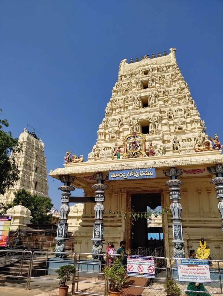
| Srisailam | Andhra Pradesh | Mallikarjuna Jyotirlinga; major Shaiva kshetra |
| Alampur | Telangana | Nava Brahma temples; sacred sangama |
| Hampi | Karnataka | Vijayanagara temple complex; Virupaksha shrine |
| Vijayawada | Andhra Pradesh | Kanaka Durga temple; Navaratri celebrations |
| Amaravati | Andhra Pradesh | Historic Buddhist and Hindu pilgrimage center |
Rituals and Pilgrimage Practices
- Bathing at sacred ghats and sangamas to purify body and mind.
- Visiting mathas and ashrams for spiritual instruction, Vedic learning, and meditation.
- Offering prayers in temple complexes aligned along the riverbanks.
- Participating in Krishna Pushkaralu, a major river festival observed once every twelve years.
The Krishna riverbanks host temple clusters, kalyani tanks, step wells, and irrigation canals that served both ritual and civic purposes. These water structures reflect Sanatana principles of ecological harmony and integrated settlement planning.
Ancient urban design along the Krishna aligned temples, bazaars, ghats, and administrative centers parallel to the river’s sacred flow. This linear sacred geography created not only spiritual continuity but also economic, social, and cultural cohesion across the Deccan plateau.
The Krishna thus remains not merely a river, but a living pilgrimage pathway — sustaining devotion, civilization, and ecological balance across southern India.

🏛️🎶 Cultural, Architectural, and Educational Centers 🏛️🎶
The Krishna River corridor is a hub for culture, architecture, and education, spanning temples, forts, step wells, ghats, and mathas. Cities like Hampi, Srisailam, Vijayawada, Amaravati, and Alampur developed along its banks, blending religion, governance, and scholarship into a cohesive cultural network.
Mathas and Acharyas
The riverbanks were home to mathas and acharya-led ashrams, serving as centers for meditation, Vedic learning, and communal life. Students and pilgrims accessed gurukuls and study circles, learning Sanskrit, ritual sciences, philosophy, temple architecture, music, and classical arts, ensuring the transmission of Sanatana knowledge across generations.
Architectural Highlights
Ghats and stepped riverbanks in Vijayawada, Srisailam, and other temple towns doubled as urban infrastructure and sacred space.
Temples along the river were designed to integrate water access, worship, and festivals.
Anicuts, tanks, canals, and kalyani step wells showcased advanced hydrological knowledge.
Temple-city layouts like Hampi integrated bazaars, mandapas, shrines, and water systems into a unified sacred-urban design.
Cultural Integration
Music, poetry, and classical dance flourished in temple complexes, especially under Vijayanagara patronage.
Pilgrimage festivals such as Krishna Pushkaralu facilitated inter-city cultural exchanges, blending economy, devotion, and education.
Imperial and regional capitals integrated spiritual institutions, administrative centers, and trade networks along the river.
The Krishna corridor thus represents a living Sanatana tapestry, where civilization, devotion, and learning coexisted, producing continuous heritage observable in urban, rural, and pilgrimage landscapes across the Deccan plateau.
🌊💧 River Type, Flow, and Hydrological Significance 🌊💧
he Krishna River is classified as a perennial, rain-fed peninsular river, originating near Mahabaleshwar in the Western Ghats and flowing eastward across the Deccan plateau before emptying into the Bay of Bengal. Unlike glacial rivers of the north, the Krishna depends primarily on monsoon rainfall, supported by anicuts, reservoirs, and tributary systems that regulate its annual flow. Its sustained discharge enabled stable agrarian civilizations across Maharashtra, Karnataka, Telangana, and Andhra Pradesh. Seasonal monsoon surges historically replenished floodplains, while engineered irrigation systems ensured agricultural continuity during drier months. This balance between rainfall and water management made cultivation sustainable and regionally predictable.
The river has numerous tributaries and distributaries that further support human settlement and ecological stability. Major tributaries include the Bhima, Tungabhadra, Ghataprabha, Malaprabha, Musi, and Munneru rivers. These tributaries enriched soils, sustained irrigation networks, and formed secondary pilgrimage corridors, with temples, ghats, and mathas located at their sangamas.
Hydrological Characteristics:
Flow Pattern: Strong during southwest monsoon; regulated through dams and reservoirs in dry seasons.
Silt Deposits: Fertile black and alluvial soils supported rice, cotton, sugarcane, pulses, and chili cultivation.
Flood Plains: Enabled groundwater recharge, delta formation, inland fisheries, and wetland ecosystems.
The Krishna’s hydrology was historically integrated into Sanatana life. Ancient settlements and temple cities were planned considering seasonal flow variations, irrigation potential, and flood control. Step wells, kalyani tanks, canals, and temple pushkarinis were strategically constructed to combine ritual purification, water storage, and agrarian use — reflecting sophisticated ecological planning.
The river supported continuous settlement across the Deccan for thousands of years.
Hydrological cycles influenced agricultural calendars, temple festivals, and Pushkaralu traditions.
The presence of perennial tributaries created secondary tirthas and matha centers, further enriching spiritual and cultural life.
In this sense, the Krishna is not merely a river but a living hydrological framework, sustaining civilization, pilgrimage, and ecological balance across southern India. Its seasonal rhythms and engineered water systems became deeply embedded in social organization, agricultural prosperity, and sacred consciousness over centuries.

🌅🏞️ Delta, Confluence, and Economic Geography 🌅🏞️
The Krishna River culminates in an expansive delta along the eastern coast of Andhra Pradesh, where it empties into the Bay of Bengal. Unlike northern confluences centered around a single sacred sangam, the Krishna’s culmination is a vast deltaic network of distributaries, fertile plains, irrigation canals, and coastal settlements. This delta became one of peninsular India’s most agriculturally productive and economically significant regions.
Fertile alluvial deposits carried from the Western Ghats and Deccan plateau enriched the lower basin for centuries. The plains around Vijayawada, Guntur, Amaravati, and the Krishna delta enabled multiple crop cycles annually. Rice cultivation especially flourished, along with sugarcane, chilies, pulses, and cotton. The integration of natural flow and engineered irrigation transformed the delta into a stable agrarian powerhouse.
Major confluences within the Krishna system — such as those with the Tungabhadra and Bhima rivers — historically became sacred and strategic nodes. These sangamas were not merely hydrological junctions but centers of temple activity, pilgrimage gatherings, and trade exchange.
Economic Significance:
Agriculture: Extensive canal systems and fertile delta soils sustained dense agrarian populations and surplus production.
Trade Routes: The river functioned as a natural east–west corridor across the Deccan, linking inland capitals with coastal ports for textile, spice, and grain trade.
Pilgrimage Economy: Festivals such as Krishna Pushkaralu and major temple yatras generated vibrant markets for ritual items, hospitality services, and artisan goods.
The Krishna shaped civilizational settlement patterns across southern India. Temple towns and administrative centers were deliberately aligned along riverbanks, integrating ghats, bazaars, irrigation channels, and educational institutions. Secondary tributary settlements also became commercial and spiritual nodes, connected through river crossings, caravan routes, and later bridge networks.
Cultural and Historical Impact:
Sacred sangamas and temple cities like Srisailam and Amaravati became major pilgrimage centers.
The lower Krishna plains supported temple clusters, mathas, and learning institutions, linking spirituality with agrarian prosperity.
Riverside capitals such as Vijayanagara thrived as administrative, artistic, and trade centers rooted in river-based geography.
In essence, the Krishna delta and its confluences represent a civilization harmonized with monsoon rhythms and engineered water systems. Ecology, economy, temple culture, and Sanatana ritual merged seamlessly, creating one of the most enduring riverine civilizations of the Deccan plateau.
📿🕉️ Pilgrimage Festivals and Ritual Practices 📿🕉️
The Krishna River is a living pilgrimage corridor, where rituals, festivals, and spiritual practices have evolved alongside the river’s flow. Pilgrimage along the Krishna represents a continuous Sanatana Yatra tradition, integrating purification, devotion, temple worship, and spiritual learning. Devotees travel along the river’s course from its origin at Mahabaleshwar through Srisailam, Hampi, Vijayawada, and Amaravati, visiting temples, ghats, and mathas along the way.

Major Ritual Practices
- Holy Dips: Bathing in the Krishna during Pushkaralu and at sacred sangamas such as Srisailam and Amaravati aligns body and mind with cosmic rhythm.
- Temple Offerings: Daily rituals at riverbank temples include abhishekam with river water, chanting of Vedic hymns, pradakshina, and donations to temples and mathas.
- Ash and Cremation Rites: Select ghats along the Krishna are used for antyeshti (last rites), reflecting the integration of life, death, and sacred river ecology within Sanatana practice.

Major Festivals
- Krishna Pushkaralu: Celebrated once every 12 years when Jupiter enters Virgo (Kanya Rashi), pilgrims perform holy dips, charity, homas, and temple rituals along the river.
- Makar Sankranti and Kartika Masam: Seasonal observances aligned with solar and lunar cycles emphasize purification, gratitude for harvest, and devotional worship at riverbanks.
- Continuous Pilgrimage Cycles: Beyond major festivals, daily pilgrims and ascetics sustain uninterrupted ritual traditions, focusing on study, meditation, and disciplined spiritual observance.

Spiritual Infrastructure
- Ghats, kalyani tanks, and stepped riverbanks function as both ritual and social spaces, supporting pilgrims with access to water, shelter, and community interaction.
- Mathas and ashrams along the river provide spiritual instruction, preserving Vedic chanting, Agama rituals, and philosophical discourse.
- Temple centers such as Srisailam and Vijayawada integrate worship, education, and cultural activity, linking river reverence with civic life.
The river itself becomes an active participant in Sanatana Yatra. Its monsoon rhythms, seasonal flow, and sacred cycles structure spiritual calendars and community gatherings. Krishna’s festivals and rituals reflect civilizational intelligence — harmonizing ecology, devotion, agricultural life, and cultural continuity across the Deccan region.
🏛️🌾 Historical Settlements Along Krishna 🏛️🌾
The Krishna River has been the cradle of some of the earliest urban and rural settlements in peninsular India. From its origin at Mahabaleshwar in the Western Ghats to its expansive delta along the Bay of Bengal, every stretch of the river has witnessed centuries of human habitation. Archaeological and inscriptional evidence points to Neolithic, Megalithic, and early historic settlements along its basin, where communities adapted to monsoon-driven river ecology to sustain agriculture, trade, temple culture, and civic life.
- Pratishthana (Modern Paithan): Strategically positioned along the upper Krishna basin trade routes, it emerged as a Satavahana capital. Excavations indicate organized habitation, trade activity, irrigation channels, and integration of ritual and civic planning.
- Srisailam: A fortified hill settlement overlooking the Krishna gorge, it evolved as both a spiritual and administrative center. Temple complexes, stepped paths, and water systems reflect integration of devotion, settlement, and ecological adaptation.
- Vijayanagara (Modern Hampi region): A dense imperial settlement aligned with the Tungabhadra–Krishna system. Its urban design incorporated bazaars, stepped tanks, canals, temples, and defensive structures in harmony with river geography.
- Vijayawada and Amaravati: Lower basin settlements that flourished due to fertile floodplains and canal irrigation. These cities became centers of trade, agriculture, pilgrimage, and learning, reinforcing the Krishna’s enduring civilizational importance.
Settlement Patterns:
Early communities chose proximity to the Krishna for fertile black and alluvial soils, seasonal yet reliable water supply, and strategic elevation for protection.
Anicuts, canals, kalyani tanks, and step wells demonstrate advanced hydrological engineering, enabling irrigation, ritual purification, and water storage during dry periods.
Urban layouts incorporated ghats, temple complexes, marketplaces, mathas, and administrative quarters, reflecting the interweaving of daily life, governance, and spiritual practice.
The Krishna corridor shaped social organization, agricultural calendars, temple networks, and trade routes across the Deccan. Continuous habitation along its banks created interconnected settlements where ritual life, education, economic activity, and survival were harmoniously integrated. It is no coincidence that major Sanatana festivals and Pushkaralu observances align with key Krishna settlements — linking geography, human habitation, seasonal rhythms, and sacred consciousness into a unified civilizational framework.
🛕🙏 Temples and Spiritual Centers 🛕🙏
The Krishna River banks are lined with temples, mathas, and ashrams, forming an enduring spiritual landscape across the Deccan. Each center serves as a pilgrimage node, a hub for education, and a site for ritual continuity. Historical and inscriptional records indicate that temples along the Krishna were not merely worship spaces — they functioned as civilizational anchors, supporting social organization, Vedic learning, irrigation management, arts, and regional trade networks.
Major Spiritual Centers:
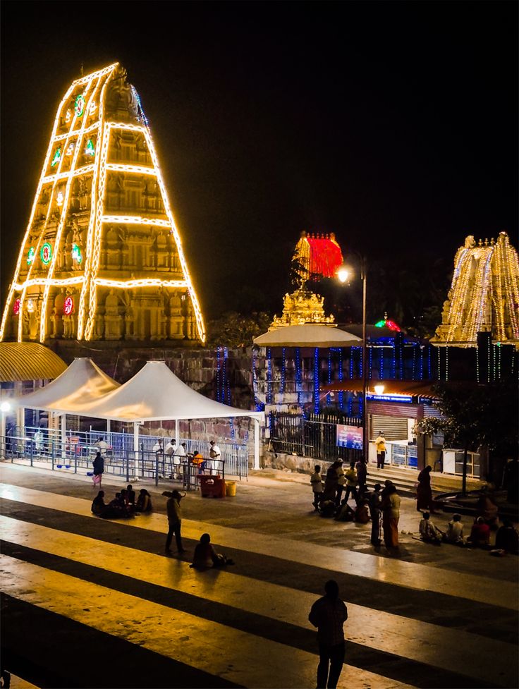
Mallikarjuna Temple, Srisailam: One of the twelve Jyotirlinga kshetras, integrating Shaiva worship, Agama learning, and monastic traditions within a fortified hill settlement overlooking the river gorge.
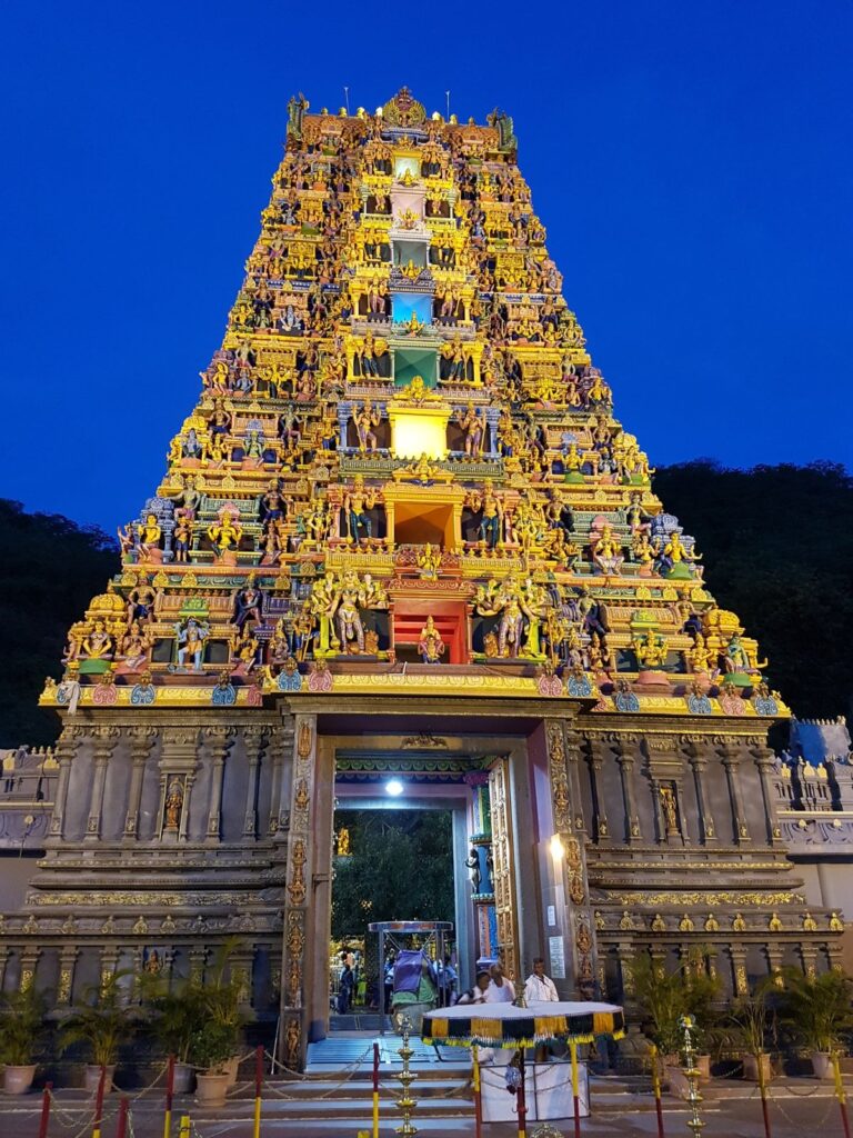
Kanaka Durga Temple, Vijayawada: A major Shakti shrine situated above the Krishna banks, hosting continuous rituals, Navaratri celebrations, and devotional gatherings.

Mahabaleshwar Temples: Near the river’s origin in the Western Ghats, these shrines symbolize the sacred source of the Krishna, marking the spiritual commencement of pilgrimage routes.
Amaravati Temple and Stupa Region: A historic sacred landscape where Hindu and Buddhist traditions flourished, linking ritual practice with scholarship and artistic heritage.
- Ghats along the Krishna serve multi-functional roles, including ritual bathing, festival gatherings, community interaction, and sacred observances.
- Mathas and acharya-led institutions provide Vedic knowledge, philosophical discourse, music, and meditation guidance, sustaining continuity of Sanatana traditions.
- Temples integrate architecture, hydrology, astronomy, and sacred geometry — reflecting an understanding of river-centered sacred geography unique to peninsular India.
The Krishna’s spiritual centers remain deeply interconnected with surrounding settlements, enabling pilgrims to traverse the river as part of a continuous Sanatana Yatra. Ritual worship, meditation, temple festivals, scriptural learning, and seasonal observances remain woven into daily life.
The river is not merely a physical watercourse — it is the sustaining lifeline of spiritual education, temple culture, agrarian stability, and communal harmony across southern India, where sacred institutions preserve continuity across centuries.

Sacred Ghats and Ritual Architecture 🏞️🕉️
Ghats along Yamuna are not just stone steps into water—they are living instruments of Sanathana philosophy. Ghats serve as ritual theaters, enabling purification, cremation, and daily worship. From Mathura to Prayagraj, each ghat narrates lessons in impermanence, devotion, and community life.
Functions of Ghats:
- Ritual Purification: Pilgrims perform ablutions at dawn, linking body and mind to cosmic rhythm.
- Life-Cycle Events: Ghats host birth rituals, marriages, and cremations, integrating spiritual continuity into daily life.
- Community Engagement: Ghats support marketplaces, learning circles, and cultural performances, blending civilian life with spiritual observance.
Notable Ghats:
| Ghat | Location | Historical/Cultural Role |
|---|---|---|
| Vishram Ghat | Mathura | Daily rituals, festival convergence |
| Kesi Ghat | Vrindavan | Life-cycle rituals, daily worship |
| Sangam Ghats | Prayagraj | Confluence rituals, Kumbh Mela, purification |
| Chaturbhuj Ghat | Fatehabad | Regional pilgrimage, community gatherings |
Ghats are multi-layered in purpose. They reflect Sanathana understanding of water as spiritual medium, connecting life, death, and cosmic cycles. Architecture harmonizes with the river, ensuring ritual, ecology, and community coexistence.

Pilgrimage Networks and Sushis 🛕🌿
The Yamuna river supports dense pilgrimage networks, integrating secondary tirthas, sushis, and muni ashrams. Pilgrims follow these networks to achieve ritual purification, spiritual guidance, and civilizational learning.
- Sushis and Ashrams: Located along tributaries and ghats, these serve as centers of meditation, teaching, and shelter for travelers.
- Interconnected Tirthas: Smaller pilgrimage points like Braj region tirthas, Kalindi Kund, and Makar Sankranti ghats supplement larger temples, providing spiritual continuity.
- Pilgrimage Cycles: Yatras often follow the river’s natural course, integrating seasonal, ecological, and ritual calendars.
The river’s network facilitates continuous Sanathana practice, making the Yamuna a living spiritual artery rather than a mere geographic feature. Pilgrimage is not tourism—it is a civilizational rhythm, where ecology, devotion, and education converge.
Urban Development and Cultural Continuity 🏙️🎨
Cities along Yamuna, from Indraprastha (Delhi) to Prayagraj, developed organically along the river’s contours. Their growth demonstrates integration of ecology, ritual, and human habitation. Ancient urban layouts incorporated ghats, step wells, sushis, marketplaces, and temples, reflecting a Sanathana worldview of civilizational harmony.
- Riverfront planning for ritual access and flood management.
- Integration of temples and ashrams into city life.
- Step wells and tanks ensuring ritual and practical water management.
These cities preserved culture, learning, and spiritual practice across millennia. Even modern settlements continue to respect river pathways and sacred sites, demonstrating the enduring legacy of Sanathana principles along the Yamuna.
Closing Reflection — Yamuna as Civilizational Lifeline 🕉️💧
The Yamuna is not merely a river; it is a civilizational consciousness, sustaining agriculture, settlements, rituals, and spiritual practice for thousands of years. Pilgrimage, ritual, temple networks, ghats, and sushis along its course exemplify Sanathana continuity, where ecology, devotion, and community are inseparable.
Its waters nurture fertile plains, sacred cities, and spiritual hubs, guiding pilgrims, saints, and scholars alike. The river exemplifies adaptation, sustainability, and spiritual integration, teaching lessons of harmony, impermanence, and collective memory.
- Yamuna supports life in physical, cultural, and spiritual dimensions.
- Pilgrimage along the river integrates ritual, learning, and community.
- Its ghats, temples, and sushis reflect centuries of civilizational wisdom, sustaining both material and spiritual life.
As long as Yamuna flows, connecting humanity with water, spirit, and sacred geography. It remains a living teacher, lifeline, and witness to India’s enduring civilizational memory.
